

 By
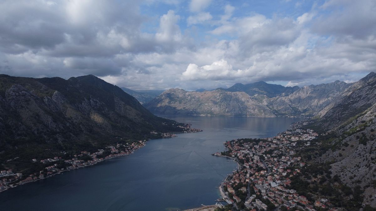
Kotor Bay is usually described as the southernmost fjord in Europe, which is geologically wrong and visually forgivable. It is a drowned river canyon, a ria, but the effect is the same: mountains dropping straight into still water, with stone towns wedged onto whatever flat ground there is.
This guide covers the three towns that define the bay, Kotor with its walls climbing the mountain, baroque Perast, and Herceg Novi at the entrance, plus how to move between them and when to come.
Why Kotor Bay is called the southern fjord
The bay cuts almost thirty kilometres inland through a wall of limestone mountains, narrowing twice to straits only a few hundred metres wide before opening again into inner basins. Whoever named it a fjord was describing the impression rather than the geology.
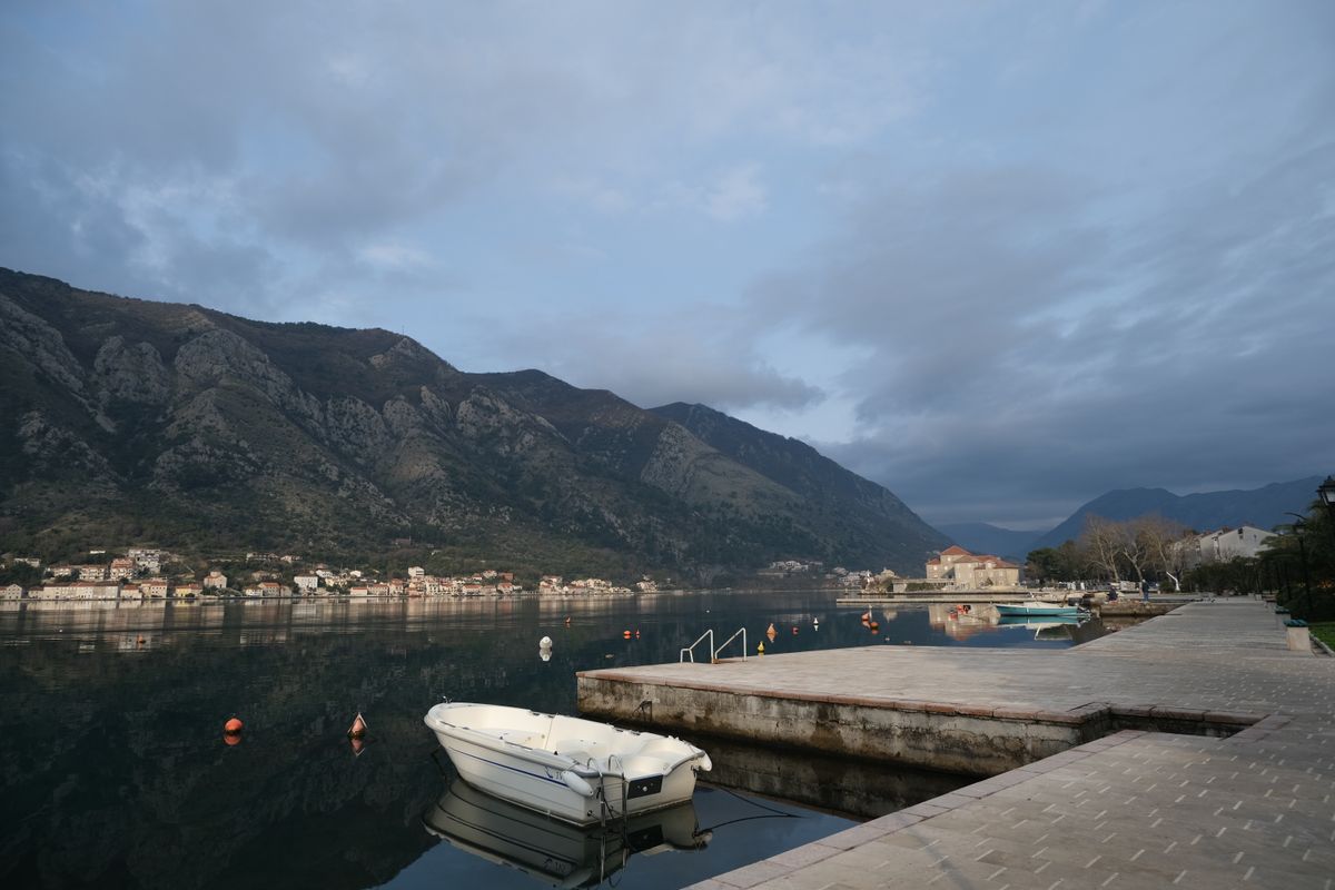
The Kotor region is on the UNESCO World Heritage list for a rare combination of nature and culture: along the shores runs an almost continuous line of stone settlements, Venetian churches and fortifications, all of it built into a landscape that barely allows building at all.
The bay has been Roman, Byzantine, Venetian, Austrian and Yugoslav, and each left something. The Venetian centuries were the longest and are the most visible, in the architecture, the winged lions over the gates and the street plans.
Kotor, the walled town
Tucked into the deepest corner of the bay, at the foot of the mountain, Kotor is its heart. The old town is enclosed in massive walls and is a triangle of lanes with no logic to them, which is deliberate: the plan was designed to confuse attackers and it still confuses visitors.
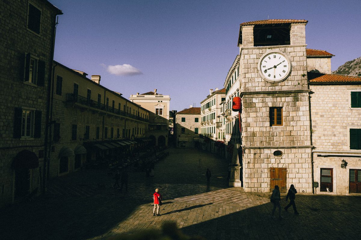
The Square of Arms, just inside the sea gate, is where you enter and where the clock tower stands. From there the town opens into a series of small squares, each with a church, and none of them signposted in a way that helps.
Kotor is also the town of cats. Strays lounge on window ledges and in every square, they have their own small museum and their own souvenir industry, and they are treated by the locals as permanent residents with rights.
The cathedral of Saint Tryphon, consecrated in 1166, is the main monument, with two asymmetrical towers, the result of an earthquake and a rebuild that ran out of money.
The walls and the fortress of San Giovanni
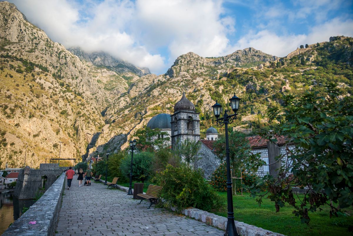
The great adventure of Kotor is climbing the defensive walls that zigzag up the mountainside to the fortress of San Giovanni, two hundred and sixty metres above the town.
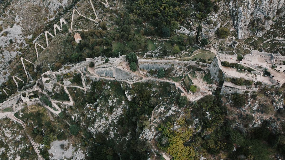
There are roughly one thousand three hundred and fifty steps, uneven, worn and without shade. The climb takes about an hour at a relaxed pace, and there is an entrance fee in season. The reward is the view straight down onto the terracotta roofs with the bay behind.
Start early in the morning or late in the afternoon: between eleven and four in summer the stone radiates heat and there is no shade at all. Take more water than you think you need, because the stalls partway up charge accordingly. There is also a free alternative, the old caravan path toward the village of Spiljari, which climbs outside the walls and joins the route further up, though it is rougher underfoot.
Perast, the baroque jewel
A quarter of an hour from Kotor, Perast looks like a stage set: a single row of stone palaces along the water, sixteen of them, with seventeen churches for a town that now has a few hundred residents.
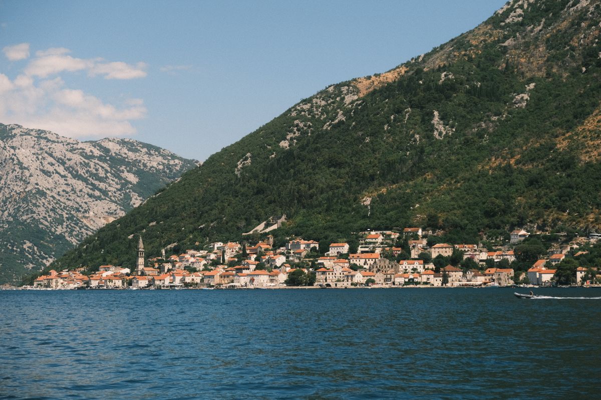
The disproportion is historical. Perast was a wealthy maritime republic whose captains served in the Russian navy, and the money came home and was spent on building. When the shipping declined, nothing replaced it, so nothing was demolished either.

Perast is visited slowly: a coffee on the promenade, the climb up the campanile for the panorama, the Bujovic and Smekja palaces, then dinner with fish at one of the waterfront restaurants. There is no beach and no nightlife, and that is the point.
Our Lady of the Rocks, the island from the legend
Two islets float in front of Perast. Saint George, with its Benedictine monastery under cypresses, is closed to visitors. The other, Our Lady of the Rocks, is artificial.
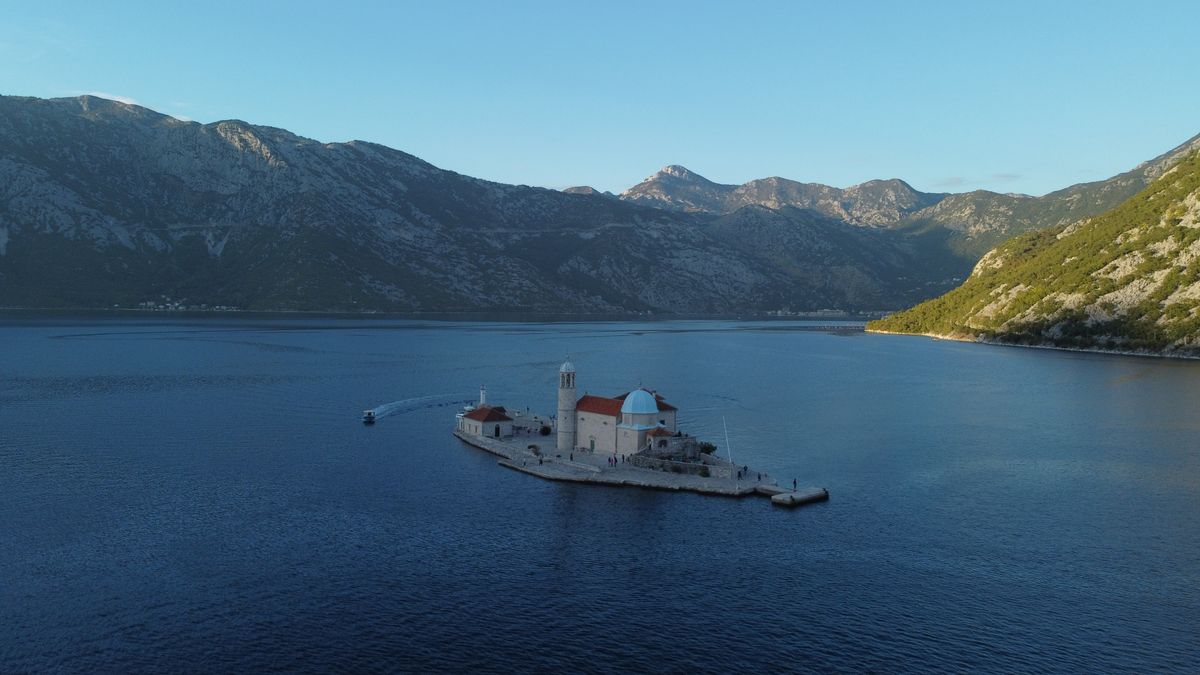
The legend says two sailors found an icon of the Virgin on a reef here in 1452, and thereafter every boat returning safely dropped a stone on the spot. Over centuries the reef became an island, and a church was built on it.
The tradition is alive. Every year at sunset on the twenty-second of July, locals row out with boats loaded with stones and throw them around the island, keeping it from eroding. The ceremony is called fasinada and it is not staged for tourists.
Boats leave constantly from the Perast waterfront for a few euros return, and the crossing takes five minutes. Inside the church, the ceiling paintings and the votive silver plaques left by sailors are the reason to go.
Herceg Novi, the town of stairs
At the mouth of the bay, facing the open sea, Herceg Novi is the town that climbs. It is built in terraces up the slope and is crossed by endless flights of steps, which makes it exhausting and gives it the best views in the bay.
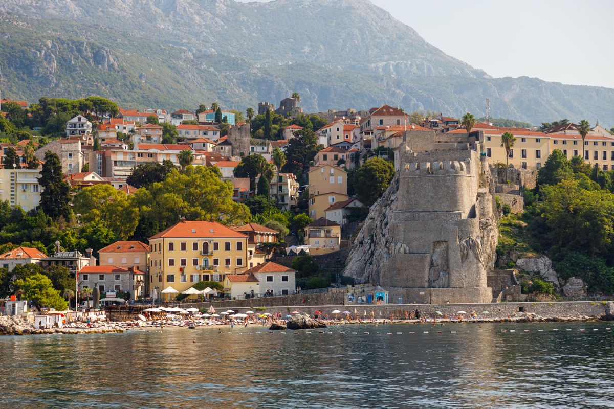
The Turks, Venetians, Spanish and Austrians each left a fortress. Kanli Kula, the Ottoman bloody tower, is now an open-air performance venue. Forte Mare guards the sea, and the Spanish fort sits highest up.
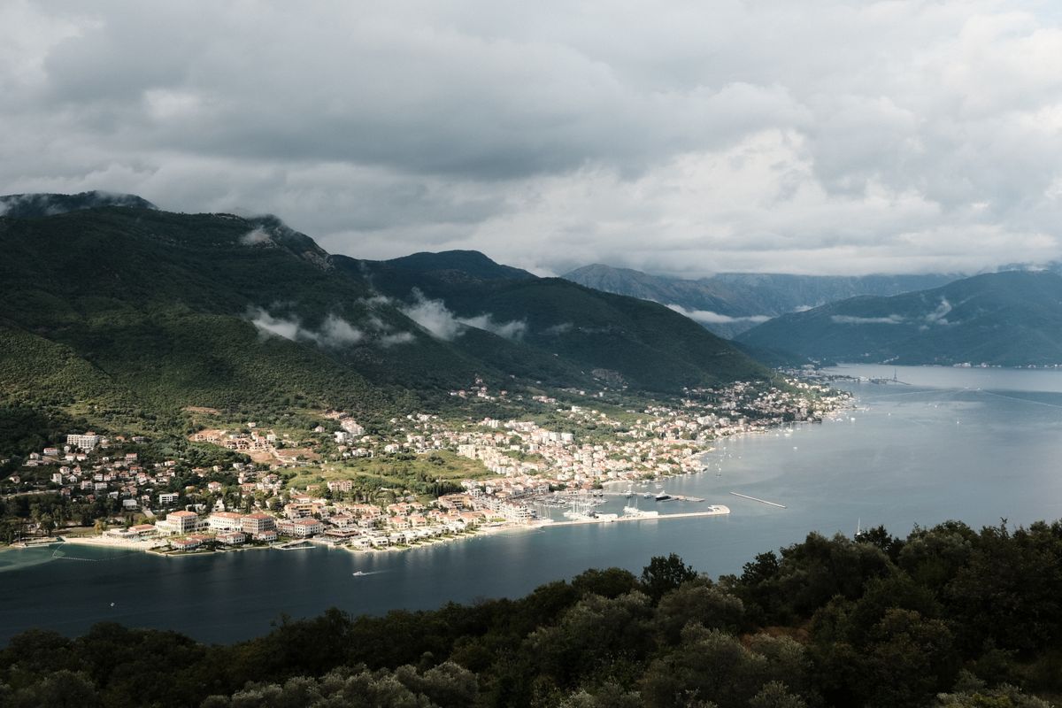
Herceg Novi has more greenery than the rest of the bay, including a botanical tradition brought back by sailors, and it gets more sun, being outside the inner basins where the mountains cut the light short.
How to move around the bay
A car is the most flexible option. The coast road runs almost the whole way round the bay, and between Kamenari and Lepetane a short ferry cuts the loop, saving about forty minutes.
The alternatives work surprisingly well. Local buses link the shore towns frequently and cheaply, water taxis run in season, and boat excursions cover the islands. For a stay based in Kotor, you can manage without driving at all.
| Route | Distance | By car |
|---|---|---|
| Kotor to Perast | 17 km | 25 minutes |
| Kotor to Herceg Novi | 43 km | 50 minutes |
| Kotor to Tivat airport | 8 km | 15 minutes |
| Kamenari to Lepetane ferry | crossing | 10 minutes |
| Kotor to Dubrovnik | 90 km | 2 hours with the border |
Parking in Kotor is the recurring problem. The lots by the walls fill by mid-morning in summer and the prices climb accordingly. If your accommodation offers a space, take it, even at a cost.
Practical advice
The bay is at its best in May, June and September: warm, green, with water good enough to swim in and without the queues of high season.
July and August bring two problems at once. Cruise ships dock at Kotor and empty several thousand people into a walled town that holds a few hundred residents, and the heat in the inner bay is intense because the mountains block the breeze. If you must come then, be inside the walls before nine or after six.
For a base, Kotor and its neighbouring villages, Dobrota, Muo and Prcanj, give the best balance of atmosphere and access. Herceg Novi suits anyone who wants more sun and more space. Perast is for those who want quiet and do not mind paying for the view.
Montenegro uses the euro without being in the euro zone, cards are widely accepted in towns and less so in villages, and background on the region is on the national tourism portal and on the UNESCO listing for the Kotor region.
Frequently asked questions (FAQ)
Conclusion
The Bay of Kotor packs an improbable amount into thirty kilometres: a walled medieval town, a baroque village that stopped growing three centuries ago, an artificial island built by sailors, and a wall climb with one of the best views in the Adriatic.
Come in May, June or September, base yourself around Kotor, climb early, and take the boat to Our Lady of the Rocks rather than only looking at it from the shore.
